

Your Custom Text Here
Location: City of Nanning, China
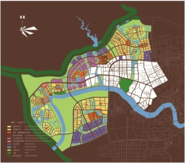
The Master Plan for the northern extension of Nanning covered 119km² to the foothills of the Guangxi Mountains to the north and west. Green corridors and rivers subdivide the Sector into cluster of districts comprised of neighborhoods.
Two systems unite the extension, the Spine Road and Yongiang River. The Spine Road connects the proposed commercial center with the City’s rail freight station. The Spine Road would link the first ring of planned neighborhoods and serve as City’s principal light rail corridor.
Location: City of Nanning, China
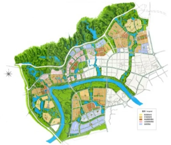
The Master Plan for the northern extension of Nanning covered 119km² to the foothills of the Guangxi Mountains to the north and west. Green corridors and rivers subdivide the Sector into cluster of districts comprised of neighborhoods.
Two systems unite the extension, the Spine Road and Yongiang River. The Spine Road connects the proposed commercial center with the City’s rail freight station. The Spine Road would link the first ring of planned neighborhoods and serve as City’s principal light rail corridor.
Nanning masterplan
Nanning detail plan